Many professional navigation tools for VFR flying have the function that the map view near the destination airfield can be switched to the approach chart and you can see the location of the Plane live. This is incredibly useful when you are at a new airfield for the first time.
The “problem” with this is that you need an annual licence for the respective air navigation app (100€ to 300€) as well as an annual licence for the DFS approach charts (60€ – 150€).
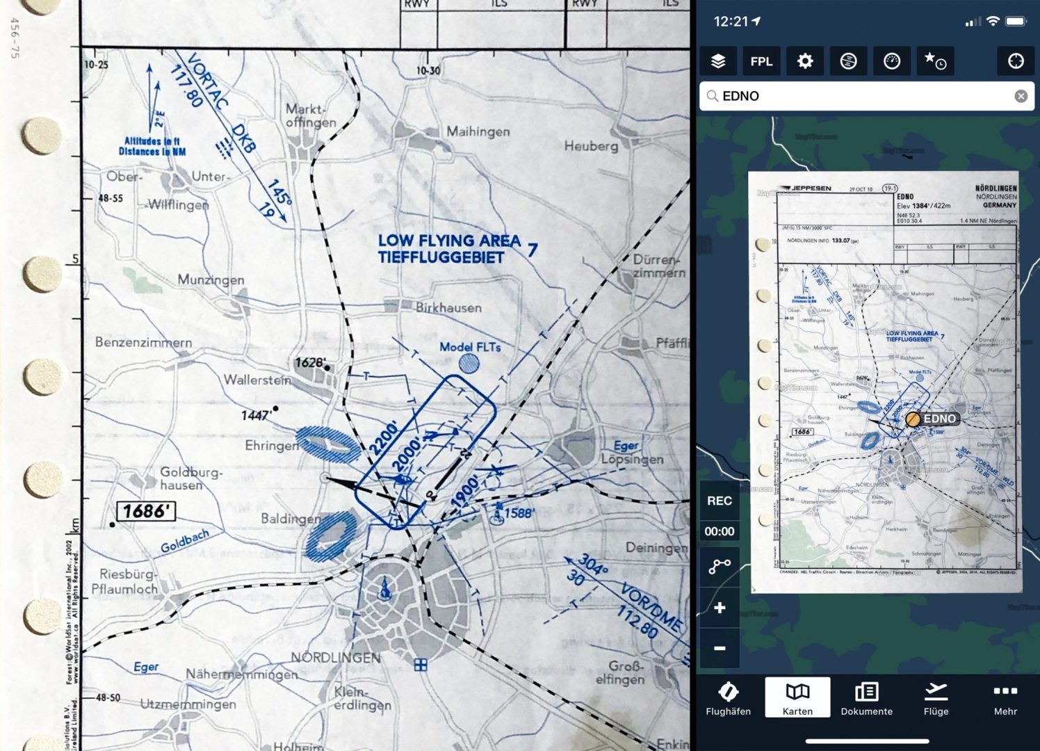
At the same time, each aerodrome operator maintains the current VFR approach charts in its Aeronautical Information Publication (AIP). It is common practice for pilots to copy this approach chart and take it with them on their flight. The approach charts are therefore available free of charge, but not digitally and far away from a moving map.
So my goal is to get the scan/image of the approach chart into a moving map – for free!
Caution: The Moving Map should only serve as an additional help in flight. Remember that electrical devices can fail. Therefore, do not forget the “sheet of paper” in the cockpit.
Digitize the AIP sheet
Whether we take a picture or scan it doesn’t matter. All we need is a high resolution .jpg image without much geometric distortion.
Georeferencing the digital AIP sheet
On the one hand we want to position the approach sheet on the correct position on the world map and on the other hand the Lamber projection is to be transferred into the WGS 86 projection.
For this I use the program MapTiler Desktop which is available for MACOS, Windows and Linux. You can also use the service online but since there is a limited number of maps available. I prefer the desktop version here. For my needs the free version is enough. You only have a watermark on the later cards.
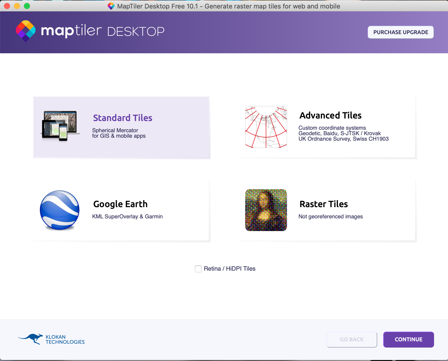
Opens the program, selects Standard Tiles and then Continue.
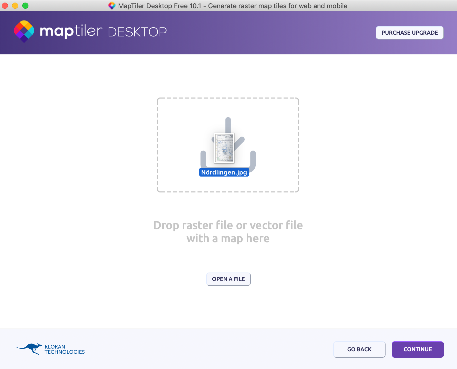
Draws the image of the approach chart into MapTiler or selects it via Open A File.
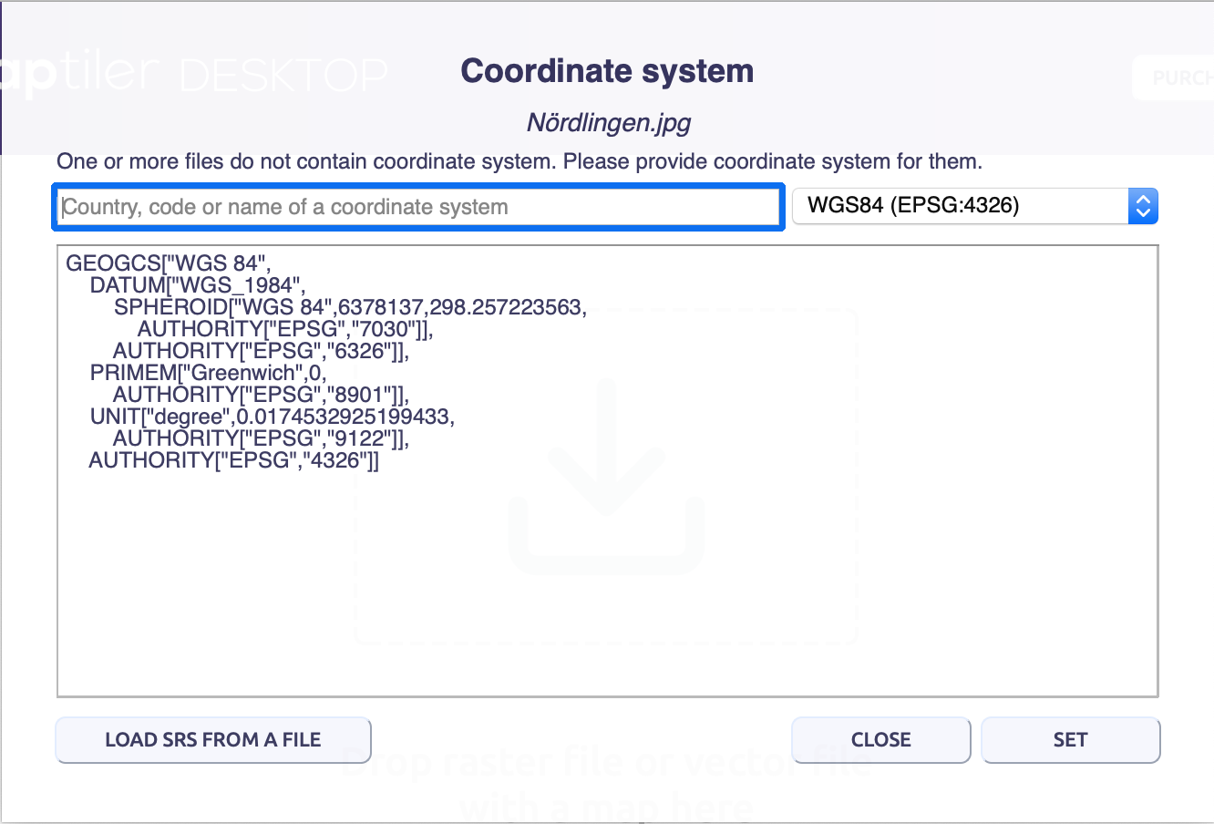
Closes the Coordinate System dialog box with SET. At this point we see that our image is transferred to the WGS86 coordinate system.
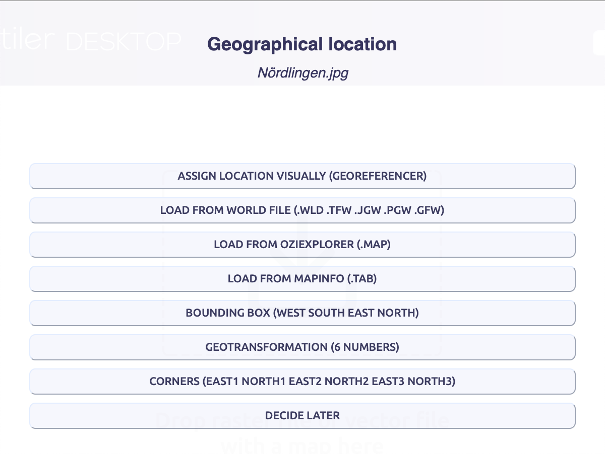
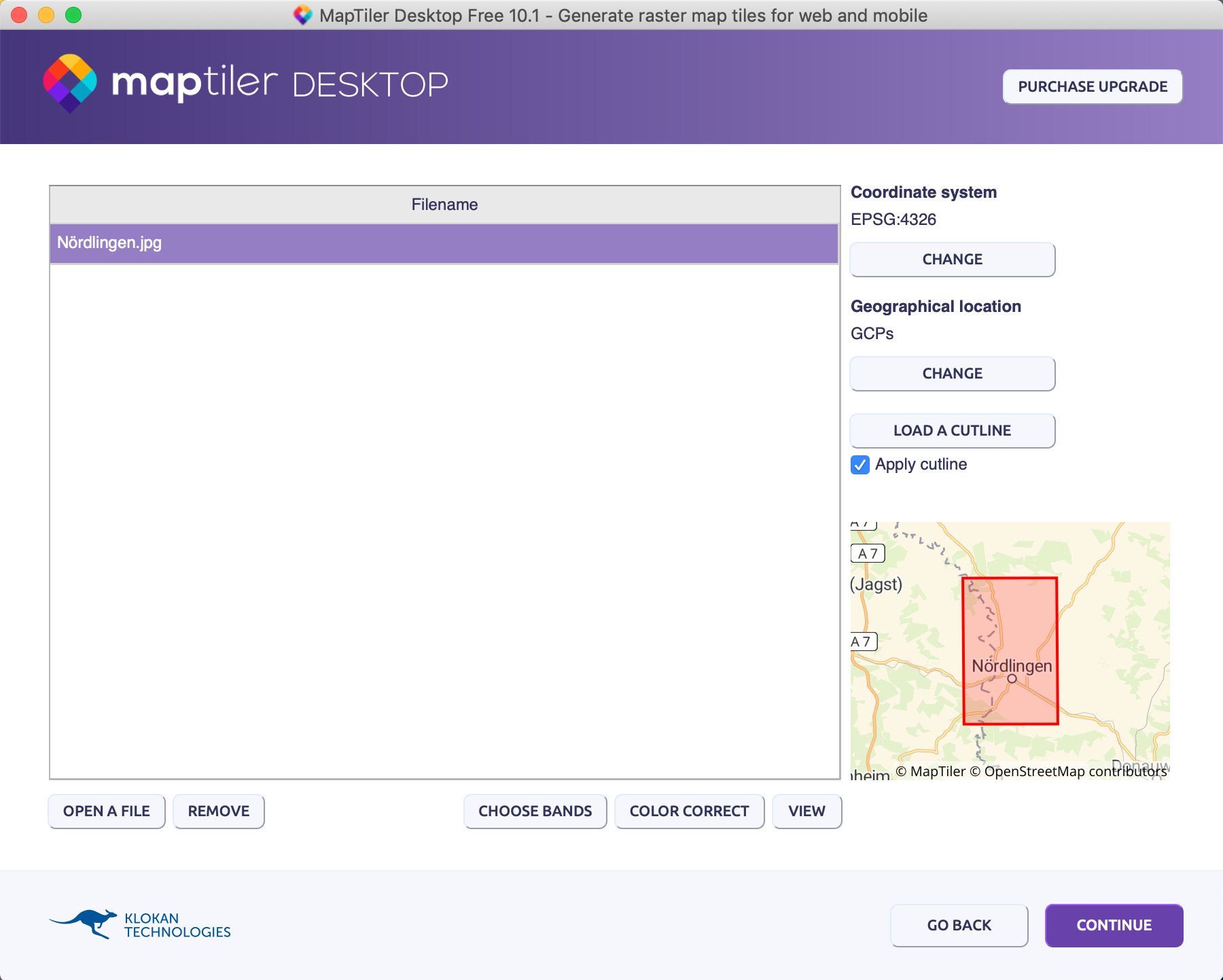
We now want to georefferencing the picture via Assign Location Visually (Georeferencer)
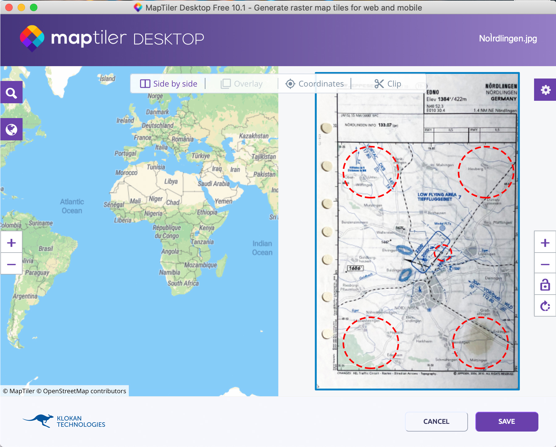
The goal in this step is to search for prominent points on the approach map and find them on the world map.
We set about 5 points for maximum accuracy. First I choose the threshold value of one of the slopes as reference point. It is convenient to connect points from the edges of the proximity map to increase accuracy. The more accurate you work here, the better.
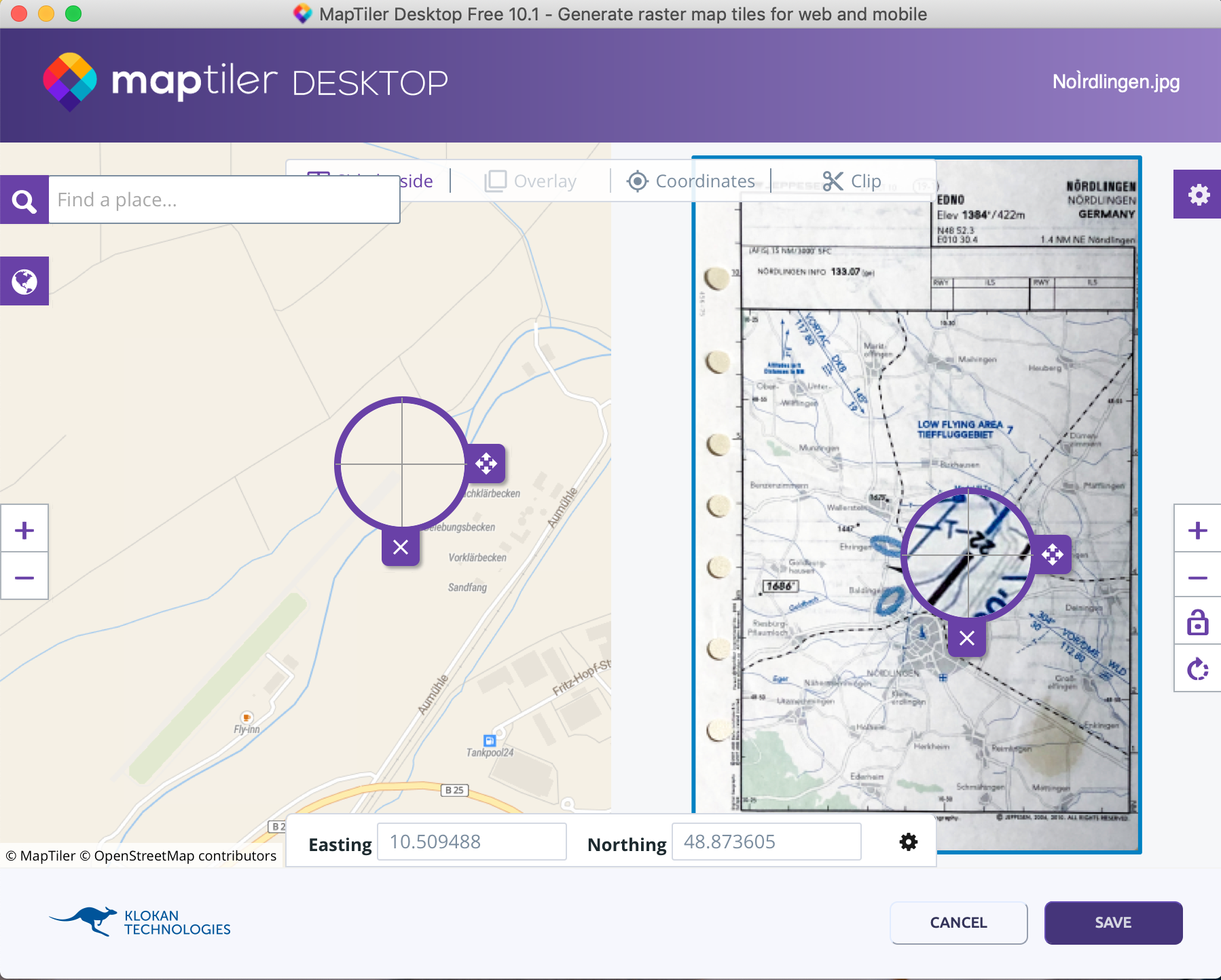
In the first step reference the runway, then four more points from the edge areas of the VFR approach chart.
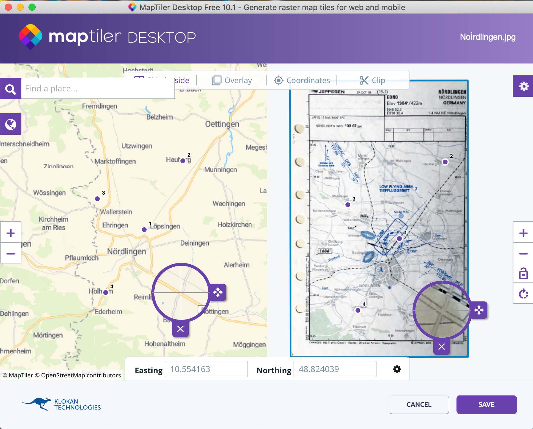
After we have set our 4-5 reference points we can save the result with Save.
In the overview we mark our georeferenced document and choose Continue.

Folder, MBTiles, Mobile device all export the same file. Select one of them and click Render.
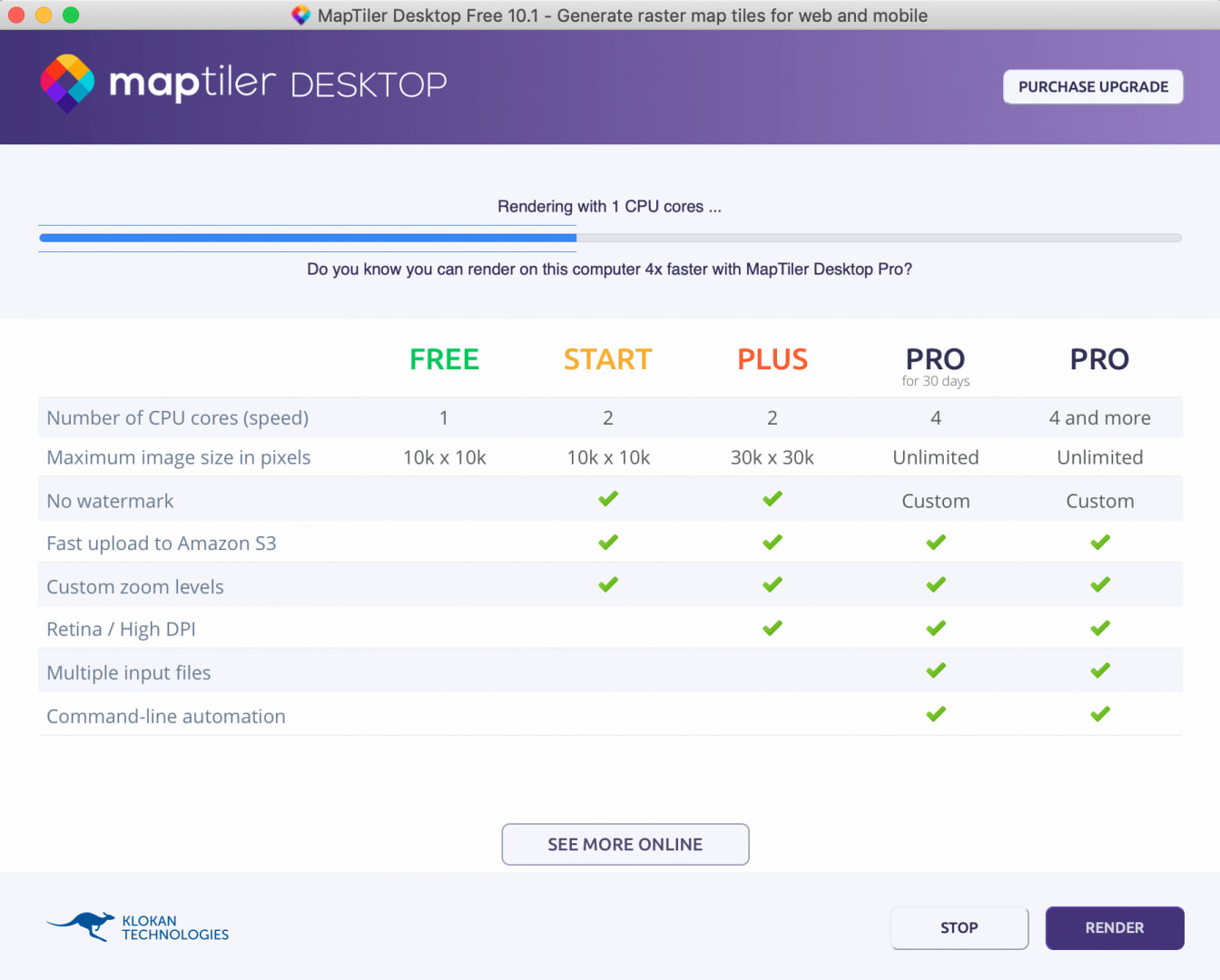
MapTiler – Render 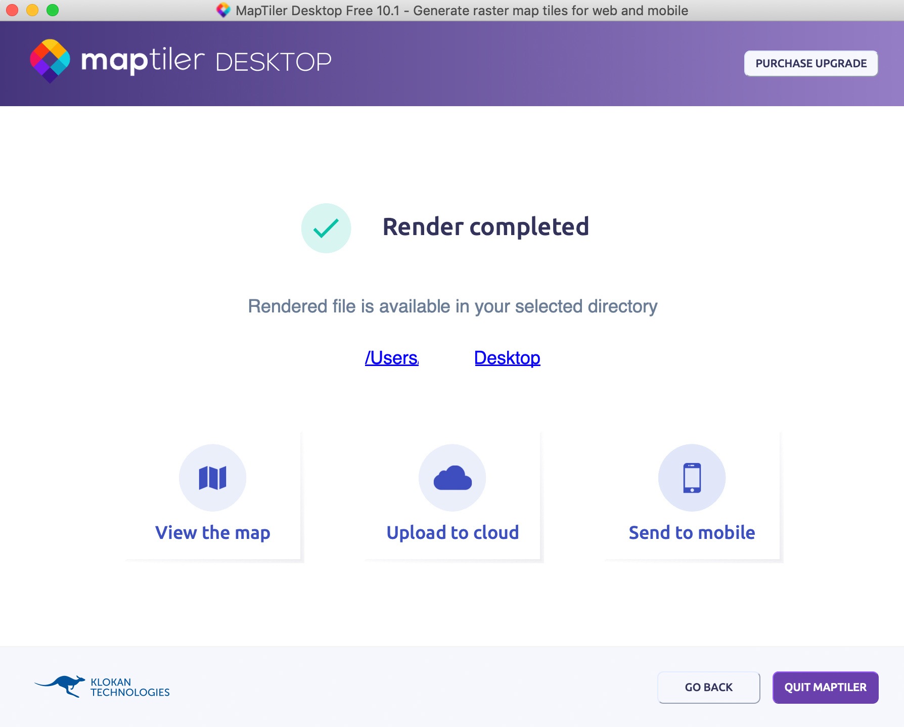
Map Tiler – View The Map
The result is a xyz.mbtiles file. You can now transfer this file to your mobile device. There are many ways to do this, via Airdrop, Mail or Cloud Sync (MapTiler offers Google Drive as a service).
You can view your result via View the map. With the slider on the right side you can change the transparency of the image. The ends of the roads on the approach map should now merge seamlessly into the roads of the world map.
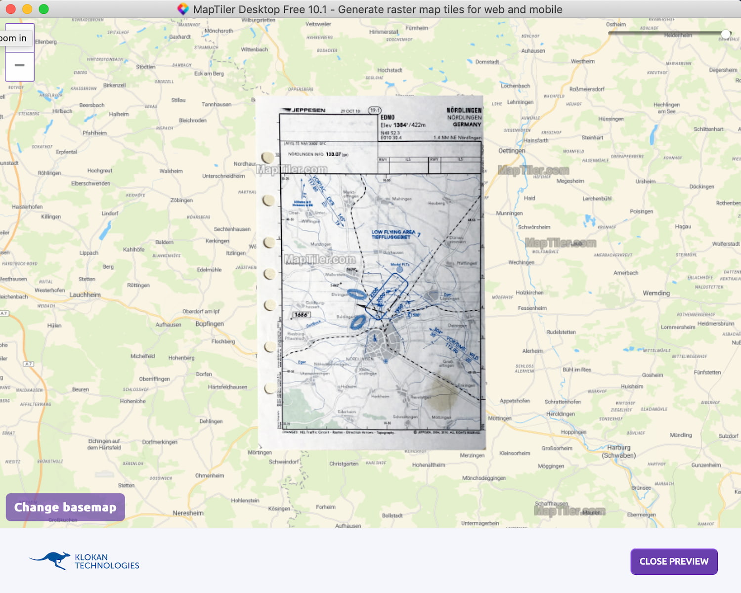
So the first step has been taken. We have provided the image with geocoordinates and adjusted the projection.
The approach chart on the mobile device
For a long time I searched for possibilities to display the .mbtiles file on the mobile device. My actual requirements were:
- Variable transparency of the approach chart
- offline capability
- Approach and deselectable approach charts
- Live positioning
I use an iPhone myself. That’s why I focused on the availability of Apple apps. I noticed positive things about it:
MapTiler GeoEditor
The manufacturer of the MapTiler software offers an app for IOS and Android which can display the .mbtiles files as an overlay on a base map. Currently this is my first choice for mobile display. What is not clear to me at the moment is where the map material is stored. The app is quite small but the maps seem to load without data connection. Possibly a lot is cached here?
Die App erfüllt zu 90% das was ich gesucht habe.The app is 90% what I was looking for.Die App erfüllt zu 90% das was ich gesucht habe.

MapTiler – Geo Editor 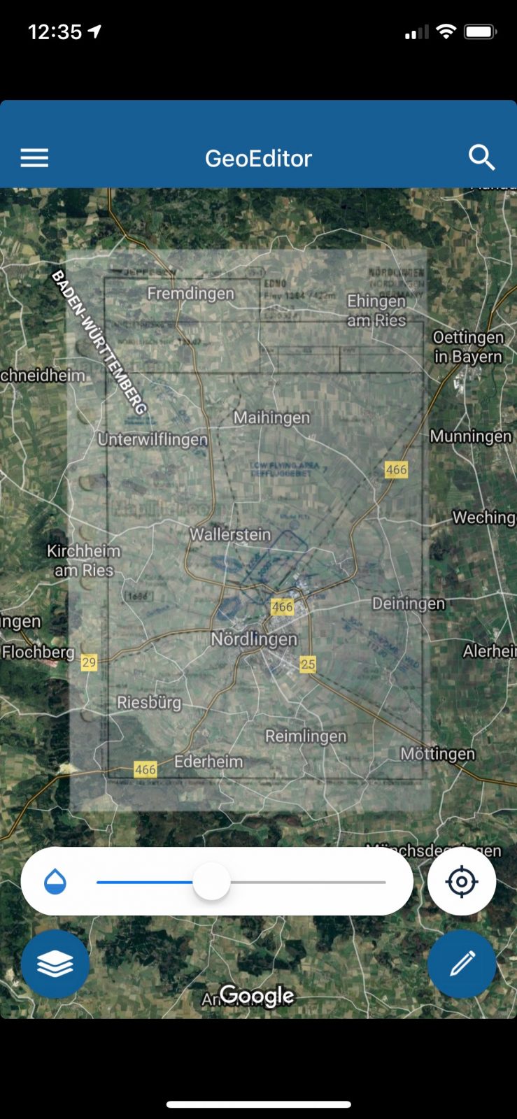
MapTiler – Geo Editor
Foreflight
Foreflight would be my first choice concerning the integration of the .mbtiles approach charts because it is actually a flight navigation system. Unfortunately Foreflight has to be paid after the 30 days test phase (at least 109,99€ per year). So if you use Foreflight anyway: Congratulations. You can save the approach charts as additional layers and select and deselect them if necessary. Only one transparency function I did not find.

Map Plus
Map Plus makes a very good impression when using the .mbtiles. Unfortunately you have to buy an InApp for some functions, e.g. the local download of Katren material, which is negligible compared to the correct flight navigation.
The app looks very tidy and can be easily individualized.

Conclusion
I get my paper approach charts integrated into a moving map and this if I want actually free of charge. The time will show how the apps perform when flying. If you still find possibilities to do the whole workflow completely on your smartphone it would be an enormous improvement. It would also be great if you could find more apps that support the .mbtiles. Let me know.
Hey, mega cooles Projekt! Schön zu sehen, dass es auch junge tech begeisterte Leute in der Luftfahrt gibt. Manchmal hab ich das Gefühl der einzige zu sein :’D
LG
Patrick